Mangystau Kazakhstan: Complete Travel Guide to the Desert Region
Comprehensive guide to Mangystau Kazakhstan including Bozzhyra, underground mosques, Caspian cliffs, road conditions, and seasonal planning.


Mangystau Kazakhstan: Bozzhyra, Caspian Cliffs and Desert Expeditions

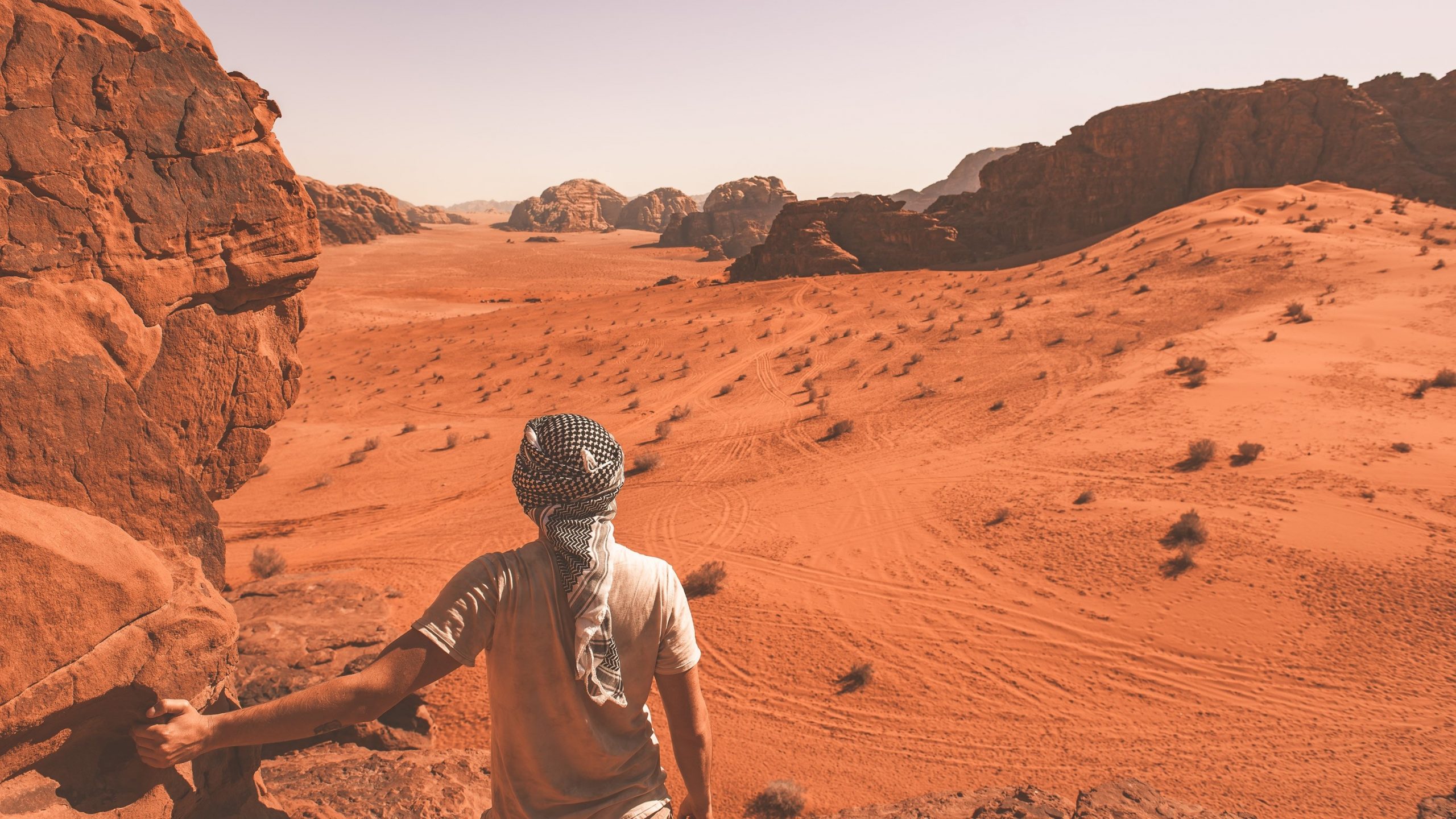
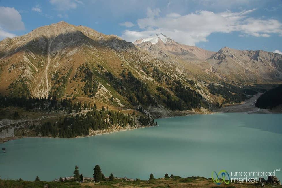
Mangystau Kazakhstan is the country’s most surreal and least populated travel region — a vast western territory shaped by chalk canyons, underground mosques, spherical stone formations, and dramatic escarpments overlooking the Caspian Sea. Unlike the alpine landscapes near Almaty, Mangystau is defined by silence, scale, and geological isolation.
Located in western Kazakhstan with Aktau as its main gateway, Mangystau Kazakhstan requires expedition-style planning. Distances are long, infrastructure is limited outside the city, and many highlights are accessible only via off-road tracks. However, for travelers seeking dramatic terrain without tourist density, Mangystau delivers unmatched visual impact.
Where Is Mangystau Kazakhstan?

Mangystau lies along the eastern shore of the Caspian Sea.
- Main city: Aktau
- Access: Domestic flight from Almaty or Astana
- Landscape: Desert plateau, limestone cliffs, inland canyons
Driving from Almaty is not practical; flights to Aktau are the most efficient option.
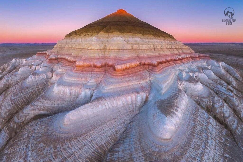
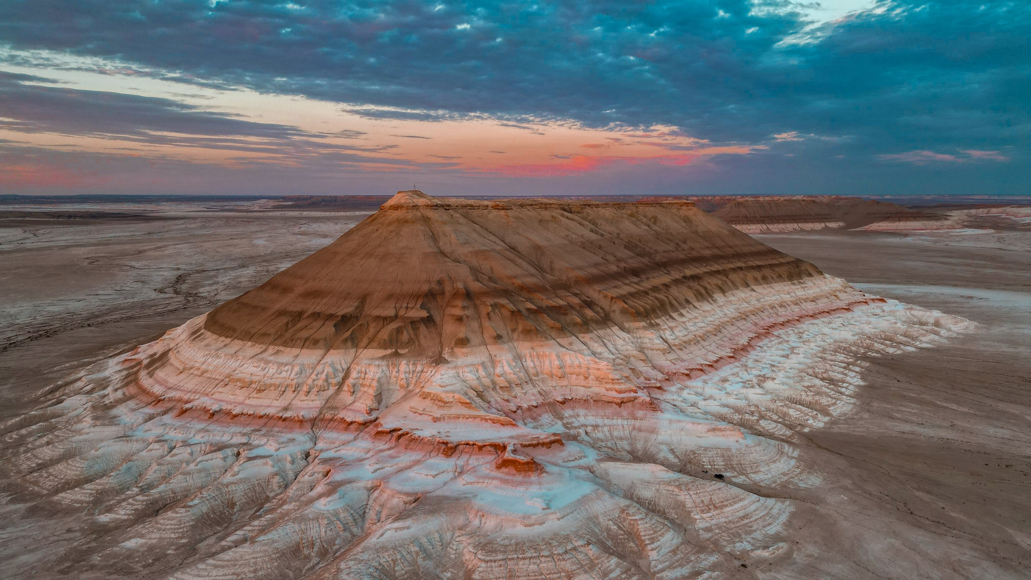
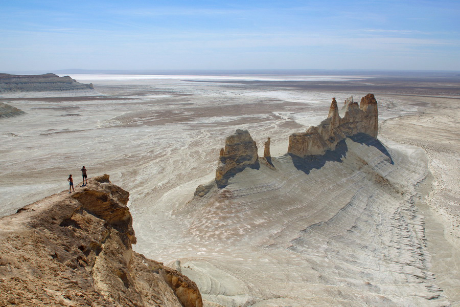
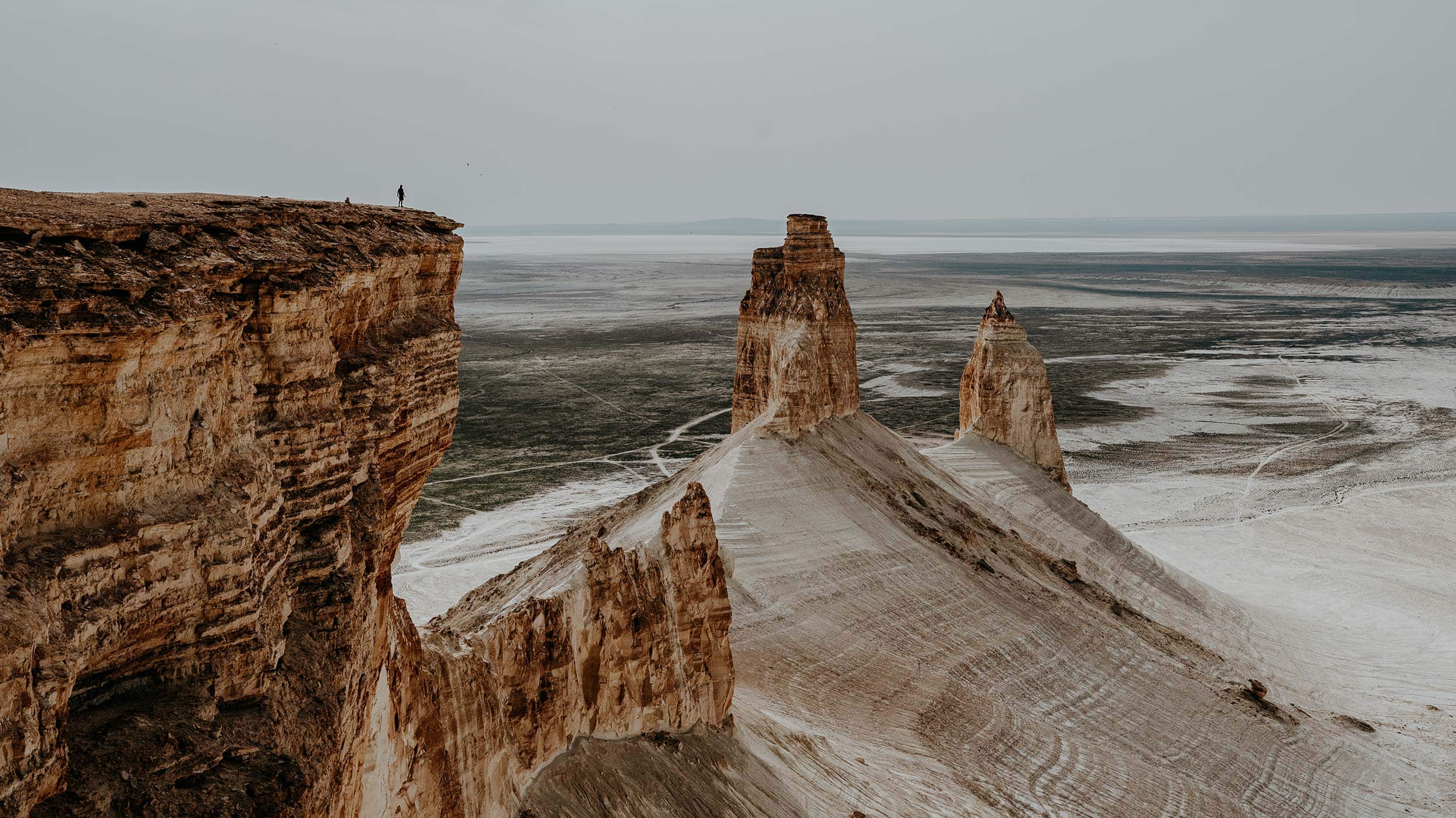
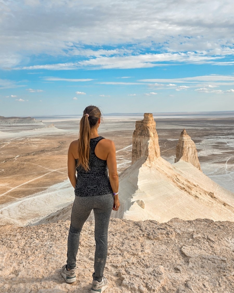
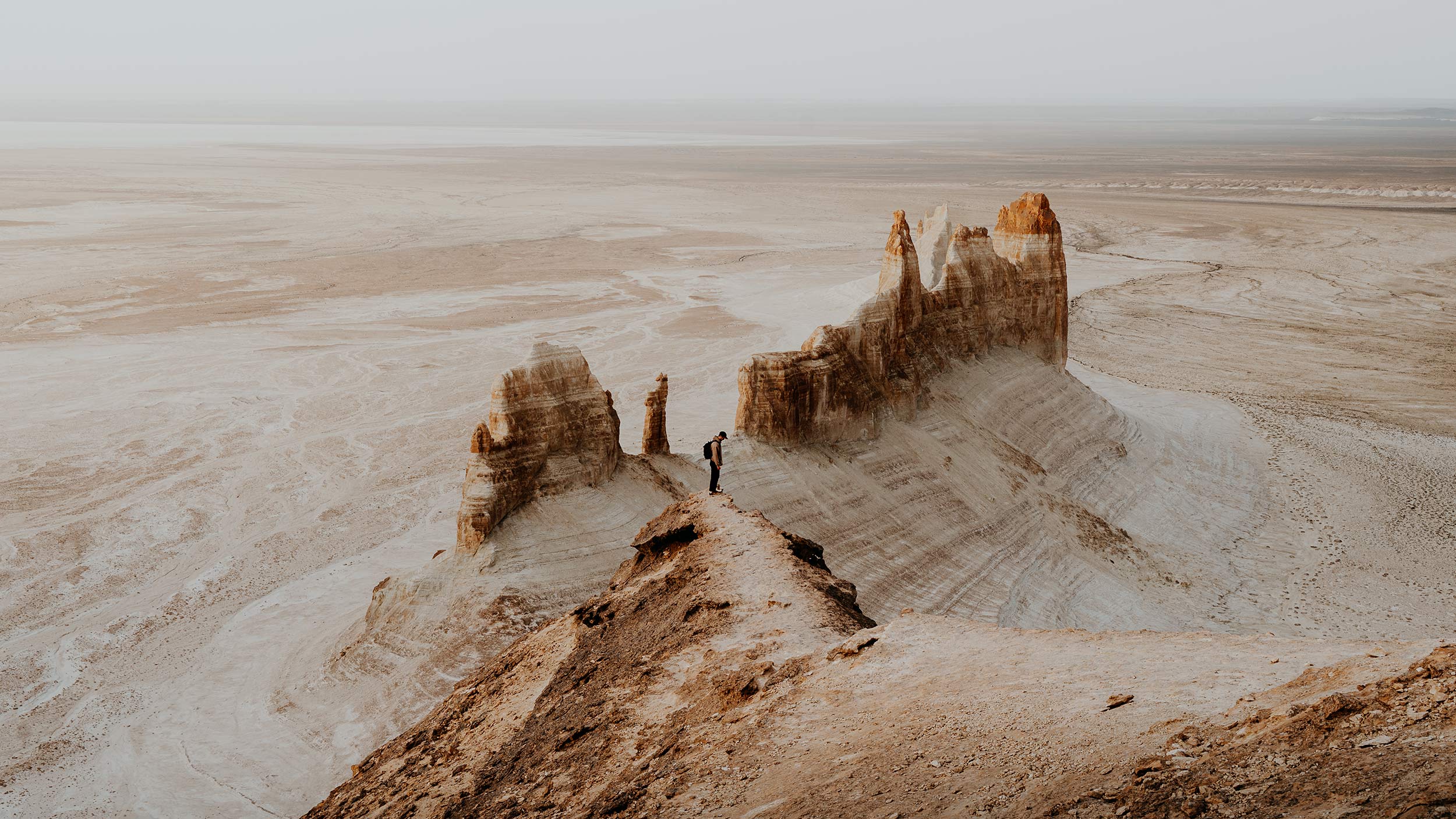
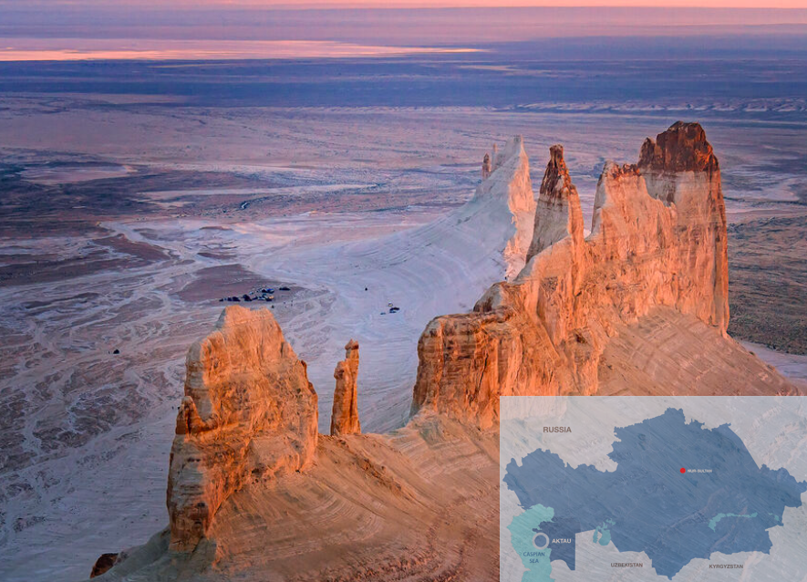
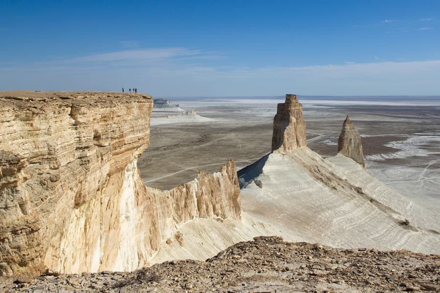
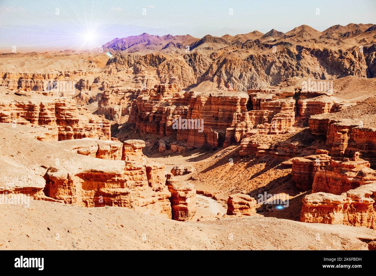
Bozzhyra: The Icon of Mangystau
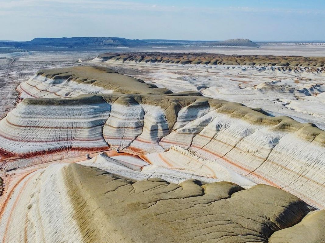
Bozzhyra is the most photographed site in Mangystau Kazakhstan.
Landscape Profile
- White limestone cliffs
- Isolated rock towers (“fangs”)
- Wide desert plateaus
Access Conditions
Requires 4x4 vehicle and experienced navigation. No marked roads.
Best Timing
Sunrise and sunset create strong shadow contrast. Midday light flattens terrain.
Bozzhyra is typically reached during multi-day desert programs.
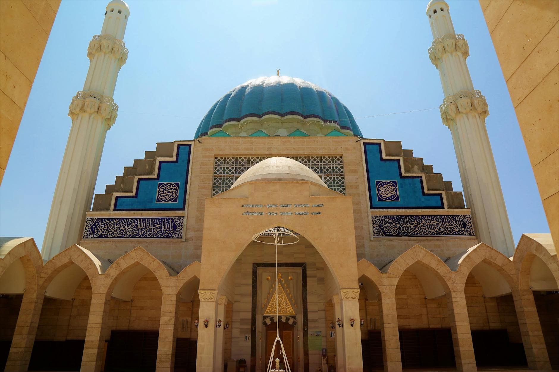
Underground Mosques of Mangystau
Mangystau is also a spiritual landscape.
Beket-Ata Mosque
Carved into rock and considered a major pilgrimage site.
Shakpak-Ata Mosque
Architecturally distinctive with carved chambers.
Visitors should dress modestly and respect local customs.
Torysh: Valley of Stone Balls
Torysh Valley contains large spherical stone concretions scattered across open terrain.
- Unique geological phenomenon
- Accessible by 4x4 vehicle
- Best visited in soft light conditions
This site adds visual diversity beyond canyon landscapes.
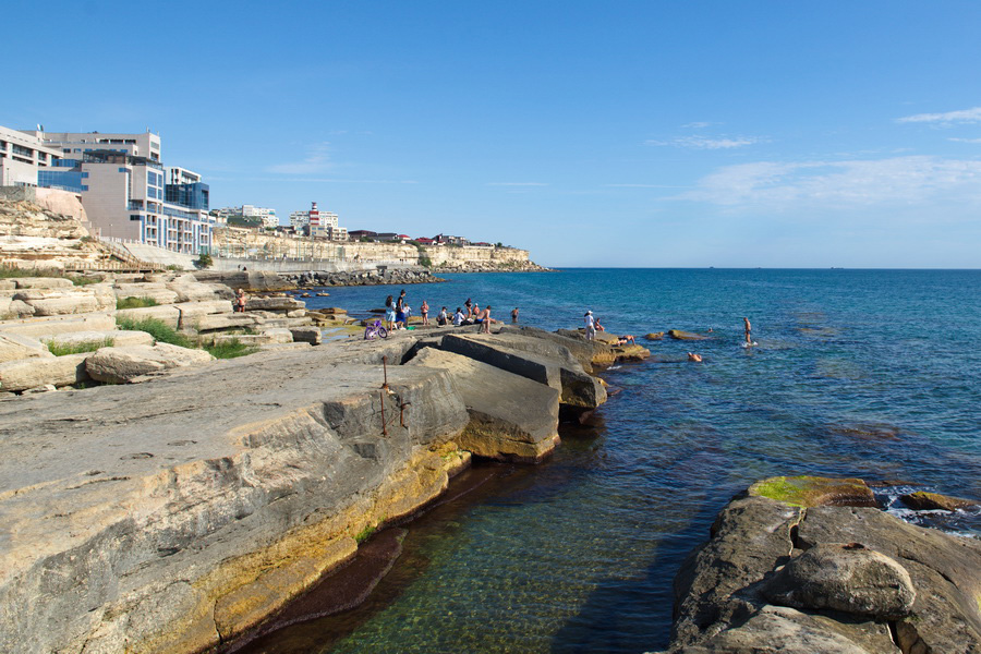
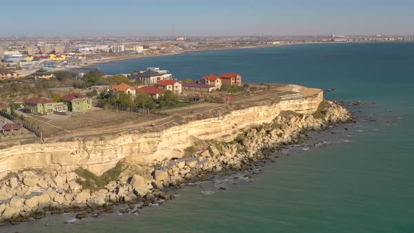
Caspian Sea Cliffs
Mangystau Kazakhstan includes dramatic coastal escarpments above the Caspian Sea.
Landscape Character
- White chalk cliffs
- Open sea horizon
- Minimal development
These coastal zones contrast sharply with inland plateau terrain.
How Many Days Are Needed in Mangystau?
3 Days (Compressed)
- Bozzhyra
- Torysh Valley
- One underground mosque
4–5 Days (Balanced)
- Full Bozzhyra exploration
- Multiple mosques
- Caspian coastline
- Additional canyon systems
Because of driving distances, fewer than 3 days significantly limits coverage.
For coordinated desert expeditions, structured Kazakhstan tours often integrate Mangystau as a standalone western extension.
Best Time to Visit Mangystau Kazakhstan
April–May
Moderate temperatures ideal for exploration.
September–October
Reduced heat and stable conditions.
Summer
Extreme heat exceeding 40°C. Midday activity unsafe.
Winter
Cold winds but accessible with proper equipment.
Shoulder seasons are strongly recommended.
Accommodation and Infrastructure
- Hotels available in Aktau
- Limited rural guesthouses
- Wild camping common during expeditions
Mangystau Kazakhstan prioritizes landscape over comfort infrastructure.
Common Planning Mistakes
Attempting Self-Drive Without Navigation Experience
GPS coverage inconsistent; tracks unmarked.
Underestimating Fuel Logistics
Fuel stations limited outside Aktau.
Ignoring Weather Forecast
Rain can turn clay tracks into impassable mud.
Who Should Visit Mangystau Kazakhstan?
- Landscape photographers
- Adventure-oriented travelers
- Visitors seeking low-density destinations
- Clients comfortable with expedition-style travel
Mangystau is not a casual add-on; it is a dedicated landscape journey.
FAQ: Mangystau Kazakhstan
Is Mangystau safe?
Yes, with proper logistical planning.
Is camping required?
For deeper routes, yes.
Can it be combined with Almaty?
Yes, via domestic flight to Aktau.
Is English widely spoken?
Limited outside tour services and hotels.
Strategic Positioning in Kazakhstan Travel
Mangystau Kazakhstan offers a geological and visual counterpoint to alpine and urban destinations. When combined with Almaty’s mountains or Astana’s architecture, it completes a multi-ecosystem narrative across the country.
Due to terrain complexity and remote conditions, professional route planning significantly improves safety and efficiency.
Mangystau is Kazakhstan’s raw frontier — vast, minimal, and unforgettable.Get a consultation from our travel specialist
We will answer all your questions about traveling in Kazakhstan and Central Asia for free. We will help you create the best itinerary based on your time, interests, and budget.
Get a consultation
Travel editor and local contributor.
Comments are moderated according to site rules. Only authorized users can write comments and save posts.
Loading comments...